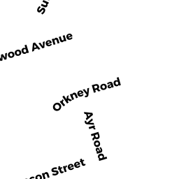
381 CHESTNUT HILL AV
Owner Information
CITY OF BOSTON
381 CHESTNUT HILL AVE
BRIGHTON, MA 02135


Property Details
381 CHESTNUT HILL AV is classified as a Improved Municipal or Public Safety, Other City or Town.
There are 1ft2 of built area within this property. There is 1ft2 of residential/living space within this property.
381 CHESTNUT HILL AV is valued at $6,358,700. The land is valued at $6,358,500 and the structures are valued at $200.
381 CHESTNUT HILL AV was last sold on Thursday, January 1, 1987 for $0.
Assessment data from fiscal year 2020.
Flood Data
According to the FEMA National Flood Hazard Layer, this property does not appear to be in a flood zone. It may also be in an area not yet reviewed. Nonetheless, confirm this information prior to taking any action.
To view the flood hazards around this property, create a FEMA "Firmette" Map of the area around 381 CHESTNUT HILL AV.
Broadband Internet Providers
| Provider | Type | Bandwidth (mbps) | |
|---|---|---|---|
| GCI Communication Corp. | Satellite | 0 | 0 |
| Comcast | Cable | 1000 | 35 |
| Verizon New England Inc. | Fiber | 940 | 880 |
| VSAT Systems, LLC. | Satellite | 2 | 1 |
| Starry, Inc. | Fixed Wireless | 200 | 200 |
| Verizon New England Inc. | DSL | 7 | 0 |
| HughesNet | Satellite | 25 | 3 |
| Viasat Inc | Satellite | 100 | 3 |
Broadband service provider data from December 2020.
Adjacent Properties
- 2400 BEACON ST PH-609
Residential Condominium owned by SIEGEL JOSEPH R - 2400 BEACON ST 106
Residential Condominium owned by MILES MARC A - 2400 BEACON ST 208
Residential Condominium owned by GUTHERY SCOTT - 2400 BEACON ST 412
Residential Condominium owned by KIM SANG YEON - 2400 BEACON ST 513
Residential Condominium owned by LEE HING CHEONG - 2400 BEACON ST 314
Residential Condominium owned by JAHNS CHRISTOPHER J - 2400 BEACON ST 411
Residential Condominium owned by SUSIANA SUSIANA - 2400 BEACON ST 413
Residential Condominium owned by LAU JUSTIN - 2400 BEACON ST 414
Residential Condominium owned by RICH SOPHIE - 2400 BEACON ST 501
Residential Condominium owned by GRILLO ANTHONY - 2400 BEACON ST 502
Residential Condominium owned by BLOCH KURT JULIUS TS - 2400 BEACON ST 507
Residential Condominium owned by KNOX CHARLOTTE B - 2400 BEACON ST 508
Residential Condominium owned by MANOLAKIS PAMELA A - 2400 BEACON ST 509
Residential Condominium owned by 1998 ARLENE J WOLK FAMILY TRUST - 2400 BEACON ST 510
Residential Condominium owned by MECCA RESOURCES INC - 2400 BEACON ST 511
Residential Condominium owned by NATHAN MICHAEL - 2400 BEACON ST 512
Residential Condominium owned by RAPOSA RAYMOND J - 2400 BEACON ST 514
Residential Condominium owned by ADLER BARBARA J - 2400 BEACON ST PH-601
Residential Condominium owned by FUDGE RICHARD E - 2400 BEACON ST PH-602
Residential Condominium owned by YOUNG LIONEL W - 2400 BEACON ST PH-603
Residential Condominium owned by JONATHAN A BENJAMIN 2003 TRUST - 2400 BEACON ST PH-604
Residential Condominium owned by TWO PIES PROPERTIES 1 LLC MASS LLC - 2400 BEACON ST PH-605
Residential Condominium owned by DEAN DEBORAH - 2400 BEACON ST PH-606
Residential Condominium owned by 606 RESERVOIR REALTY TRUST - 2400 BEACON ST PH-607
Residential Condominium owned by RICHARDSON BRUCE - 2400 BEACON ST PH-608
Residential Condominium owned by BURGUNDY-PRYTANIA LLC - 2400 BEACON ST 101
Residential Condominium owned by BURDICK AMY - 2400 BEACON ST 102
Residential Condominium owned by PATRICK COURTIN 1992 TRUST - 2400 BEACON ST 103
Residential Condominium owned by SMIRKO REALTY TRUST - 2400 BEACON ST 107
Residential Condominium owned by FARRELL SUSAN L - 2400 BEACON ST 108
Residential Condominium owned by KOMINS ROGER - 2400 BEACON ST 111
Residential Condominium owned by NABULSI ZAKERIAH - 2400 BEACON ST 112
Residential Condominium owned by REIN MILDRED TS - 2400 BEACON ST 201
Residential Condominium owned by RUOPP CHARLES P - 2400 BEACON ST 202
Residential Condominium owned by WISE BETSY - 2400 BEACON ST 203
Residential Condominium owned by KEMLER BETH - 2400 BEACON ST 204
Residential Condominium owned by KEMLER ANDREA - 2400 BEACON ST 205
Residential Condominium owned by GELS PAUL - 2400 BEACON ST 206
Residential Condominium owned by LAWLESS ALICIA A - 2400 BEACON ST 207
Residential Condominium owned by BUSTILLO SAMIRA J - 2400 BEACON ST 209
Residential Condominium owned by ROTHBERG DAVID L - 2400 BEACON ST 210
Residential Condominium owned by WONG BRIAN - 2400 BEACON ST 211
Residential Condominium owned by ALBANO JULIANNE E JT - 2400 BEACON ST 212
Residential Condominium owned by LEE DEANA C - 2400 BEACON ST 214
Residential Condominium owned by KURKO SARAH - 2400 BEACON ST 215
Residential Condominium owned by PATEL SUNIL - 2400 BEACON ST 301
Residential Condominium owned by SOLOMON JUDITH - 2400 BEACON ST 302
Residential Condominium owned by POULOS GEORGIA TS - 2400 BEACON ST 304
Residential Condominium owned by LISSA R KAPUST 2009 REVOCABLE TRUST - 2400 BEACON ST
Other, Open Space owned by WATERMARK CONDO TRUST - 2400 BEACON ST 305
Residential Condominium owned by WONG JEANINE - 2400 BEACON ST 306
Residential Condominium owned by ALVES MANUELA A - 2400 BEACON ST 307
Residential Condominium owned by ANDRADE ANTONIO - 2400 BEACON ST 308
Residential Condominium owned by CHIU JOY - 2400 BEACON ST 309
Residential Condominium owned by BUTTERFIELD COLIN - 2400 BEACON ST 310
Residential Condominium owned by GERSHKOVICH JULIA - 2400 BEACON ST 311
Residential Condominium owned by BEREZIN ELLEN - 2400 BEACON ST 313
Residential Condominium owned by SUMMERS RICHARD G TS - 2400 BEACON ST 315
Residential Condominium owned by KORMAN MARTIN W TS - 2400 BEACON ST 403
Residential Condominium owned by LEWIS MARK S - 2400 BEACON ST 405
Residential Condominium owned by GARCIA MANUEL - 2400 BEACON ST 406
Residential Condominium owned by BAI XIAO - 2400 BEACON ST 407
Residential Condominium owned by ROBERT F CAPALBO LIVING TRUST - 2400 BEACON ST 408
Residential Condominium owned by KATHARINE YANG SHAW LIVING TRUST - 2400 BEACON ST 409
Residential Condominium owned by PRESSLER EDNA J - 2400 BEACON ST 410
Residential Condominium owned by WINSTON LESLEE - 2400 BEACON ST 109
Residential Condominium owned by ROSENBAUM DIANE STRAUSS - 2400 BEACON ST 110
Residential Condominium owned by SOLOMON ILENE - 2400 BEACON ST 402
Residential Condominium owned by CALLAGHAN PATRICK J - 2400 BEACON ST 505
Residential Condominium owned by CHO KUMME - 2400 BEACON ST 114
Residential Condominium owned by FLETCHER H WILEY 2019 REVOCABLE TRUST - 2400 BEACON ST 404
Residential Condominium owned by LAMORIELLO TIMOTHY M - 2400 BEACON ST 504
Residential Condominium owned by LESLIE AND ESTHER - 2400 BEACON ST 503
Residential Condominium owned by FRANK A FAGGIANO 1997 FAMILY TRUST - 2400 BEACON ST 401
Residential Condominium owned by GASSEL VITALITY - 2400 BEACON ST 113
Residential Condominium owned by BONISTALLI JOHN J - 2400 BEACON ST 303
Residential Condominium owned by BARDAWIL RONALD G - 2400 BEACON ST 506
Residential Condominium owned by TABBAH CORRENE - 2400 BEACON ST 105
Residential Condominium owned by KONSTANTOPOULOS CONSTANTIN - 2400 BEACON ST 213
Residential Condominium owned by GOLDSWEIG HOWARD G TS - 2400 BEACON ST 104
Residential Condominium owned by 104 RESERVOIR REALTY TRUST - 2400 BEACON ST 312
Residential Condominium owned by GIPSTEIN SHERYL A - 381-399 CHESTNUT HILL AV HOTEL
Hotels owned by CLEVELAND CIRCLE HOTEL OWNER LLC - 375 CHESTNUT HILL AV
Other, Open Space owned by CLEVELAND CIRCLE PRIMARY CONDOMINIUM ASSOCIATION L - 381-399 CHESTNUT HILL AV RESIDENTIAL
Mixed Use (Primarily Residential, some Commercial) owned by CLEVELAND CIRCLES SENIOR HOUSING OWNER LLC